 vesseltracker.com
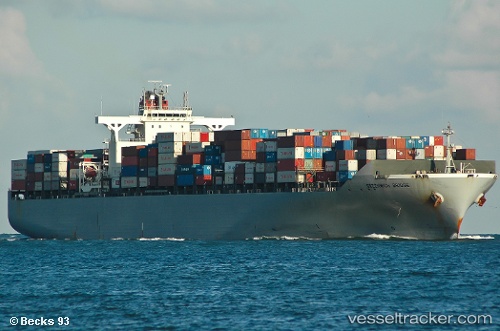
Vessel MSC ANAHITA IMO: 9302085, MMSI: 636020918 Container Ship
UTC, 22.49842, -91.31533, course: 61, speed: 15.3
UTC, 22.77427, -90.80862, course: 63, speed: 15.6
2026-02-27 11:39:34 UTC, 23.00083, -90.36909, course: 61, speed: 15.8
Live AIS position:
UTC. 34 nm S of Munshiganj),
updated 2026-02-27 11:39:34 UTC.
Find the position of the vessel MSC ANAHITA on the map. The latter are known coordinates and path.
marine traffic ship tracker show on live map
The current position of vessel MSC ANAHITA is 23.00083 lat / -90.36909 lng. Updated: 2026-02-27 11:39:34 UTCCurrently sailing under the flag of Liberia
MSC ANAHITA built in 2006 year
Deadweight:
71270 tDetails:
Last coordinates of the vessel:
UTC, 22.28600, -91.74125, course: 64, speed: 15.5UTC, 22.49842, -91.31533, course: 61, speed: 15.3
UTC, 22.77427, -90.80862, course: 63, speed: 15.6
2026-02-27 11:39:34 UTC, 23.00083, -90.36909, course: 61, speed: 15.8